Jump to content


Photo

Quick q before I get started


  • Please log in to reply
8 replies to this topic

#1 jt83

jt83

    Advanced Member

  • Members
  • PipPipPip
  • 1,024 posts

Posted 15 May 2017 - 03:56 AM

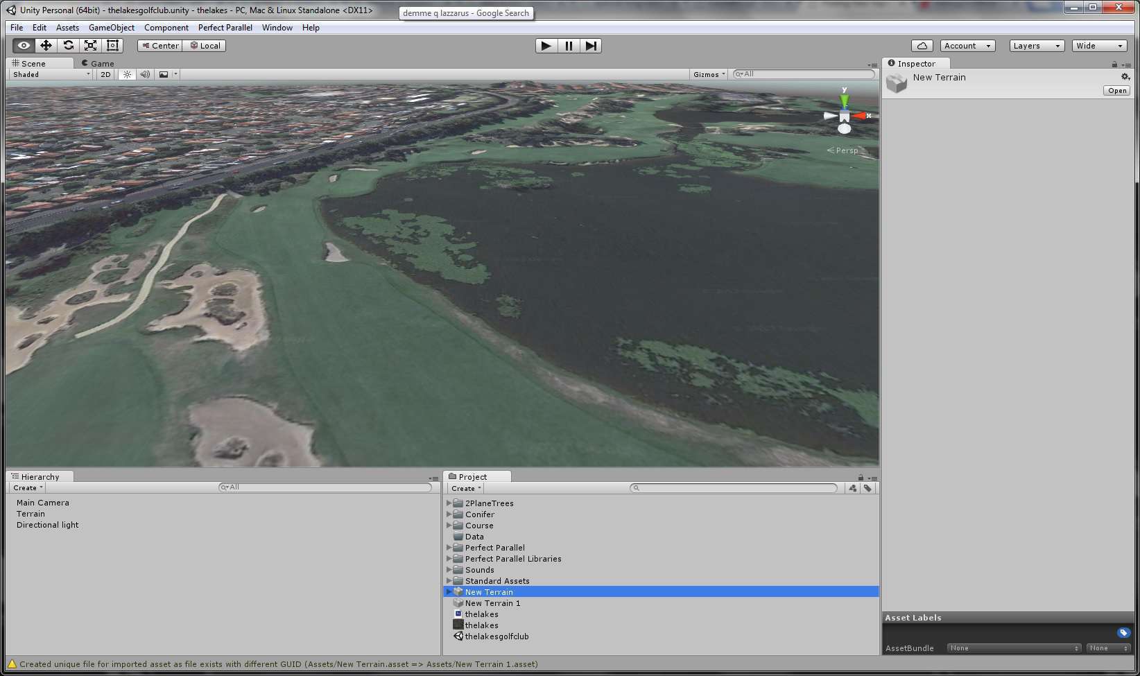
I'm creating a real course using the lidar tutorials (the last step being importing the terrain into Unity).  I've just imported CourseForge on top of it.  Down the bottom the message is - "Created unique file for imported asset as file exists with different GUID (New Terrain 1.asset).  I'm assuming New Terrain appears when CF is imported and New Terrain 1 refers to that message.  Just making sure I can delete them both before moving on.


250797308100702699653c67869dfb68f7ce073e


#2 Unique

Unique

    Advanced Member

  • Members
  • PipPipPip
  • 322 posts
  • LocationBrisbane, Queensland, Australia

Posted 15 May 2017 - 06:39 AM

The Lakes Golf course in Sydney. Excellent


#3 axe360

axe360

    Advanced Member

  • Members
  • PipPipPip
  • 6,219 posts
  • LocationSo Cal U.S.A.

Posted 15 May 2017 - 11:38 PM

Hey jt83,  Only advice I would say is, Leave them alone!  I have always had bad luck when removing any of those terrain files.

That's my best advice.  I make backups with the CF backup terrain function and I just name them the same name as the Save Scene As option. So if I ever have to go back I can match them both up.

I have several terrain saves in my project folder. Now some may have different advice but hey, you can't go wrong if you don't remove them.


Peace


Done with designing.

Released Courses: Real

The Golf Club @ Dove Mnt. AZ

Aronimink PA

Amana Colonies Iowa

Fictional:

The Grinder Anytown U.S.A.


#4 Unique

Unique

    Advanced Member

  • Members
  • PipPipPip
  • 322 posts
  • LocationBrisbane, Queensland, Australia

Posted 16 May 2017 - 05:33 AM

Where did you get the lidar data from? please?


Peter


#5 jt83

jt83

    Advanced Member

  • Members
  • PipPipPip
  • 1,024 posts

Posted 16 May 2017 - 06:24 AM

Hi Peter,


The Lakes data is from elevation.fsdf.org.au/  The data there can be downloaded in point cloud format, which Global Mapper loves.  Don't get too excited about the Lakes, I'm a first-timer already running into issues  :lol:


There'a also ELVIS at ga.gov.au/elvis/ but it doesn't export the data in Global Mapper language, as far as I know.  I think it works in Terraland, as Larrykuh was able to make height maps.  Was there a course you were looking at?


Hey jt83,  Only advice I would say is, Leave them alone!  I have always had bad luck when removing any of those terrain files.

That's my best advice.  I make backups with the CF backup terrain function and I just name them the same name as the Save Scene As option. So if I ever have to go back I can match them both up.

I have several terrain saves in my project folder. Now some may have different advice but hey, you can't go wrong if you don't remove them.


Peace


Thanks axe, yeah saving the scene and terrain at the same time is a note I made going through the tutorials.

  • axe360 likes this

#6 Unique

Unique

    Advanced Member

  • Members
  • PipPipPip
  • 322 posts
  • LocationBrisbane, Queensland, Australia

Posted 17 May 2017 - 12:12 AM

I would like to do one of those courses along the coast near Maroubra or another one down the south coast at Narooma and also The Vintage at Hunter Valley, but I am further behind you in regards to importing data. I tried Elvis but couldn't work it out. I have been out of action for 2 years with no computer so I am starting my skills back at square one.

Good Luck with the design. I have some Aussie bird sounds that might come in handy if you need them.


Peter


#7 jt83

jt83

    Advanced Member

  • Members
  • PipPipPip
  • 1,024 posts

Posted 18 May 2017 - 01:18 AM

The Vintage doesn't have point cloud data but anywhere around Sydney should be fine.  Let me know if you pick one and I should be able to do up a height map.


#8 worrybirdie

worrybirdie

    Advanced Member

  • Members
  • PipPipPip
  • 892 posts
  • LocationPismo Beach, California

Posted 18 May 2017 - 01:33 AM

I assume you have bitten the considerable bullet of the Global Mapper subscription fee. This is what is what's keeping me from progressing (yes, I know I could go and get the Lidar data by hitting up one of the many kind souls out there who have the subscription, but I really think I should be able to do it myself.  Terrain Forge...where art thou!).


#9 jt83

jt83

    Advanced Member

  • Members
  • PipPipPip
  • 1,024 posts

Posted 18 May 2017 - 04:42 AM

I say hit them up!  A neighbour has Global Mapper and the reason I annoy him is because I wanted to be able to do a course without bothering anyone, but now that I have a course to work on, I think it's going to be a while before I do another.  Spend the time waiting on TerrainForge in CourseForge.


0 user(s) are reading this topic

0 members, 0 guests, 0 anonymous users