Jump to content


Photo

Heightmap Data U.K


  • Please log in to reply
40 replies to this topic

#21 Mick-S

Mick-S

    Advanced Member

  • Members
  • PipPipPip
  • 397 posts
  • LocationDevon.u.k / born London

Posted 03 February 2014 - 11:40 PM

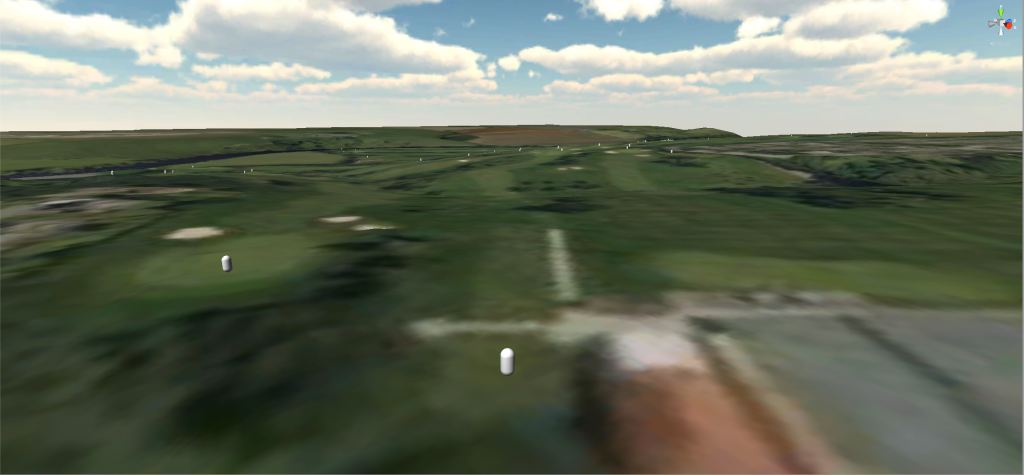
ah o.k it gives 3 views OS / DTM and DSM the one in the pic, not sure if doing U.K couses is possible without a decent heightmapAttached File  Image2.jpg   104.23KB   1 downloads


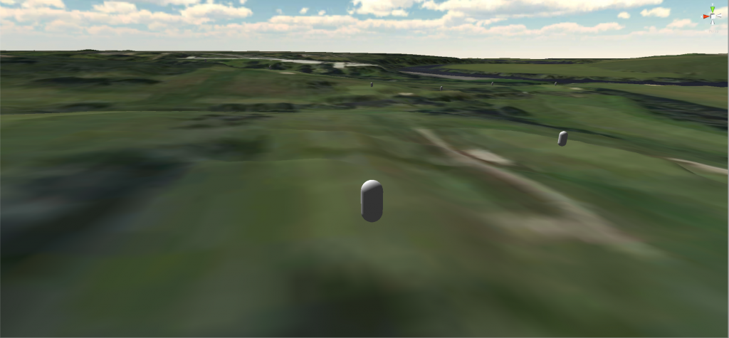
managed to get the heightmap data for free but there is a slight problem, unlike the U.S site where you create a box around the area you want so the heightdata and overhead match, the site I used has the map tiled so if your course happens to go over into the next tile you get data you didn`t really want, mine was 8 tiles, I may have done something wrong but don`t know what.


#22 Brucey Mc

Brucey Mc

    Advanced Member

  • Members
  • PipPipPip
  • 438 posts
  • LocationTeesside, UK #UTB

Posted 05 February 2014 - 06:52 PM

Got my data too, trying to get it into Unity now.........


#23 Mick-S

Mick-S

    Advanced Member

  • Members
  • PipPipPip
  • 397 posts
  • LocationDevon.u.k / born London

Posted 05 February 2014 - 08:34 PM

Got my data too, trying to get it into Unity now.........

o.k  let me know how you get on


#24 nyt1976

nyt1976

    Newbie

  • Members
  • Pip
  • 5 posts

Posted 06 February 2014 - 04:54 PM

Mick,

You haven't done anything wrong - there is a facility to draw a polygon around the area you want to get the LIDAR data for, but whenever I've used it, it hasn't worked so I have had to resort to using the 1km squares.......

Glad you managed to get the data for free though.


#25 Mick-S

Mick-S

    Advanced Member

  • Members
  • PipPipPip
  • 397 posts
  • LocationDevon.u.k / born London

Posted 06 February 2014 - 06:03 PM

Mick,

You haven't done anything wrong - there is a facility to draw a polygon around the area you want to get the LIDAR data for, but whenever I've used it, it hasn't worked so I have had to resort to using the 1km squares.......

Glad you managed to get the data for free though.

maybe when the terrain importer is released I may be able to make use of the data, because at the moment I have 9 DTM files ( SU9666_DTM_1M.asc. like this, and 9 JPG files ( SU9666_DTM_1M.jpg, like this, and no idea what to do with them, lol.


#26 remers

remers

    Advanced Member

  • Members
  • PipPipPip
  • 204 posts

Posted 06 February 2014 - 08:53 PM

Hiya guys.

I've been experimenting briefly with some DTM files (.asc extensions) that I successully obtained from the Geomatic website for a location in the UK and I thought I'd share with you a couple of useful things I've discovered.

The first is a page describing the process of converting DTM/DEM files to Greyscale heightmaps:

http://scrawkblog.co...te-height-maps/

and the second is a link to the software mentioned on this page:

http://www.usna.edu/...icrodemdown.htm

You'll need the 'Core Microdem Install' link and it will prompt you to install help files and the extra Borland database packages.

Once installed, you should be able to create the necessary greyscale heightmaps required by Unity from DTM/DEM files.

It's very early days for me in terms of Unity/Terains/Heightmaps etc but I thought this might help others :)


System Spec
---------------------
Win10 / Core i7 - 4820k 3.7Ghz / 16GB Ram / GeForce GTX780 / Corsair M95 Wired Mouse / Asus PB287Q 28in 4k Monitor


#27 Davefevs

Davefevs

    Advanced Member

  • Members
  • PipPipPip
  • 454 posts
  • LocationBristol

Posted 07 February 2014 - 03:53 PM

I've just ordered the LIDAR data for my local course. I couldn't select the tiles either, until I realised that if I click the tile two the the right and one down, it selects the one I want....bonkers! £1250!!!!

#28 Brucey Mc

Brucey Mc

    Advanced Member

  • Members
  • PipPipPip
  • 438 posts
  • LocationTeesside, UK #UTB

Posted 07 February 2014 - 06:22 PM

Dave did you claim it was for non-commercial use?


#29 Davefevs

Davefevs

    Advanced Member

  • Members
  • PipPipPip
  • 454 posts
  • LocationBristol

Posted 07 February 2014 - 06:44 PM

At £1250, I most certainly did!

It said that they would check out my order.....will I get a download, or a DVD?

No idea what to do with the data when I get it :-)

#30 Brucey Mc

Brucey Mc

    Advanced Member

  • Members
  • PipPipPip
  • 438 posts
  • LocationTeesside, UK #UTB

Posted 07 February 2014 - 06:50 PM

If you get approved its a download link to a zip file.


#31 shimonko

shimonko

    Advanced Member

  • Members
  • PipPipPip
  • 1,718 posts

Posted 07 February 2014 - 10:42 PM

Generously, they claim they send out a DVD even for non-commercial (free) orders if the download is beyond a gig or something.


Those who have received it, did you get high resolution overhead photos as well, or just the height data? I saw there was an option for relief shaded maps (which are no good), but not imagery.


#32 remers

remers

    Advanced Member

  • Members
  • PipPipPip
  • 204 posts

Posted 08 February 2014 - 12:20 AM

Hi Shimonko.
No, I didn't and I don't recall that being an option.
I did receive jpg versions of the dtc data but I used the .asc files within Microdem which worked really well. I still need to create myself an overhead though and that's going to be a tricky job matching it up with the heightmap accurately.

System Spec
---------------------
Win10 / Core i7 - 4820k 3.7Ghz / 16GB Ram / GeForce GTX780 / Corsair M95 Wired Mouse / Asus PB287Q 28in 4k Monitor


#33 Brucey Mc

Brucey Mc

    Advanced Member

  • Members
  • PipPipPip
  • 438 posts
  • LocationTeesside, UK #UTB

Posted 08 February 2014 - 10:02 AM

Same for me Remers, Microdem gave a fairly decent height map, now just trying to manually get a decent overhead to match it with.


#34 Mick-S

Mick-S

    Advanced Member

  • Members
  • PipPipPip
  • 397 posts
  • LocationDevon.u.k / born London

Posted 08 February 2014 - 01:08 PM

although I shouldn't complain as it was free no decent overhead to match the height data is a bit useless, the pic in post 21 is the best you get, I suppose you could place a decent overhead on to that as you can see some of the fairways, but as I said before have no idea what to do with the asc files, am I right in thinking terrain importer will stich the 9 files together ?.

we may have to except that U.K courses are going to be a bit more of a challenge, getting a overhead to match the height data etc.


#35 shimonko

shimonko

    Advanced Member

  • Members
  • PipPipPip
  • 1,718 posts

Posted 08 February 2014 - 01:13 PM

I just placed an order for Hillside GC next to Birkdale, see how it goes--hopefully they don't notice my Australian IP address. 


#36 shimonko

shimonko

    Advanced Member

  • Members
  • PipPipPip
  • 1,718 posts

Posted 08 February 2014 - 01:26 PM

although I shouldn't complain as it was free no decent overhead to match the height data is a bit useless, the pic in post 21 is the best you get, I suppose you could place a decent overhead on to that as you can see some of the fairways, but as I said before have no idea what to do with the asc files, am I right in thinking terrain importer will stich the 9 files together ?


It did in the tut with tiled data from the US's equivalent service, so it should.


#37 Brucey Mc

Brucey Mc

    Advanced Member

  • Members
  • PipPipPip
  • 438 posts
  • LocationTeesside, UK #UTB

Posted 08 February 2014 - 02:17 PM

I have managed to get my course terrain and a overhead into Unity.  It's not perfect but a pretty decent effort I think.  Here are some screenshots of what it looks like, the capsules are Tee and Green markers:


1. High view of the course from the 1st TeeScreenShot2014-02-08at135150.png


2. The view from the 17th Tee

ScreenShot2014-02-08at135332.png


3. The view from the 6th Tee

ScreenShot2014-02-08at135318.png


4. Saving the best till last, the view from the 14th Tee, along the River Tees.

ScreenShot2014-02-08at135345.png


  • shimonko likes this

#38 Mick-S

Mick-S

    Advanced Member

  • Members
  • PipPipPip
  • 397 posts
  • LocationDevon.u.k / born London

Posted 08 February 2014 - 03:25 PM

Thanks shimonko lets hope so

while I am waiting will continue my other hobbie skinning V8 Supercars

some early 2014 liveries, WIPAttached File  Image22.jpg   100.08KB   0 downloads


#39 shimonko

shimonko

    Advanced Member

  • Members
  • PipPipPip
  • 1,718 posts

Posted 08 February 2014 - 10:14 PM

Looks to line up pretty well Bruce, not sure there's anything more you could have done when you say it's not perfect.

@ Mick, coincidentally I used to skin cars for rfactor.


#40 Brucey Mc

Brucey Mc

    Advanced Member

  • Members
  • PipPipPip
  • 438 posts
  • LocationTeesside, UK #UTB

Posted 08 February 2014 - 10:16 PM

It's a little out in a places but I guess thats how it lays itself out from a flat image onto a non flat surface.  Its good enough I think!


1 user(s) are reading this topic

0 members, 1 guests, 0 anonymous users