

View Other Content
Categories See All →
Search Articles
Recent Articles
Recent Comments
-
 Tropical Environment test
3199E5kennetharry - Dec 19 2014 07:15 PM
-
Tropical Environment test
3199E5kennetharry - Dec 19 2014 07:13 PM
-
Anatomy of a practice area
3199E5kennetharry - Dec 19 2014 07:11 PM
-
Some virtual camera fun
3199E5kennetharry - Dec 19 2014 07:08 PM
-
 Fly By Creation Tool
perfparwigit - Sep 16 2014 04:17 AM
-
Our characters first steps
3199E5kennetharry - Aug 27 2014 12:23 PM

Importing National Map Viewer into Course Forge
Jun 03 2013 11:07 PM |
Andrew
in Corporate
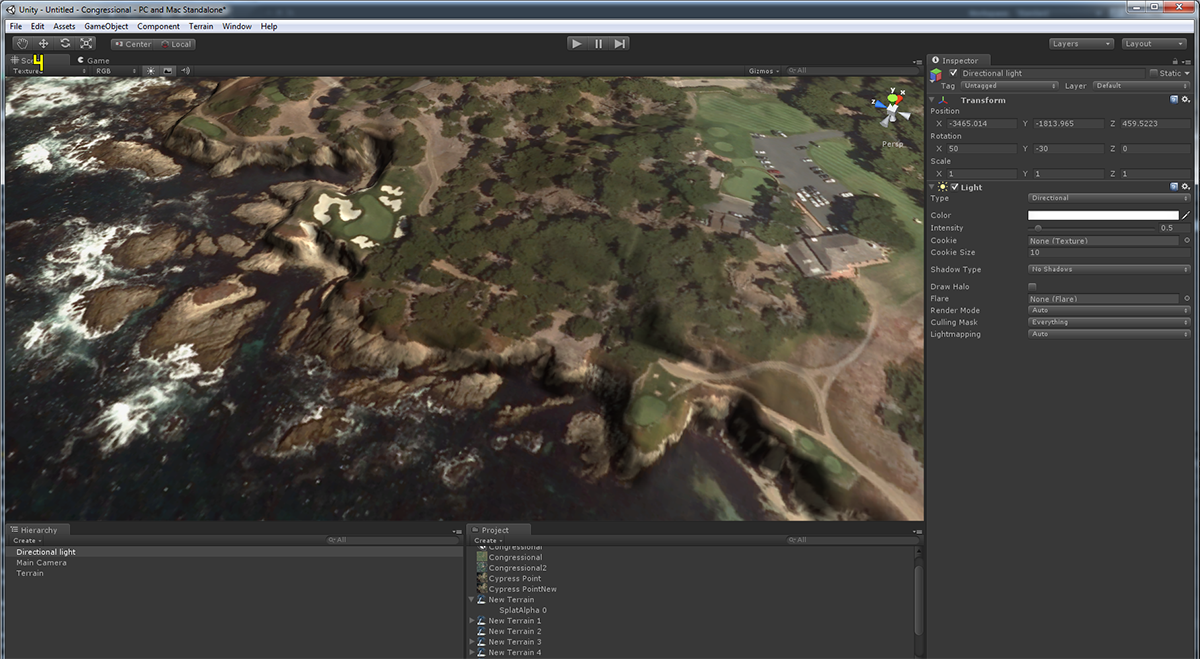 Perfect Parallel has released a video showing how easy it is to take data from the USGS National Map Viewer site which contains high resolution 3M (1/9 ARC Second) data available for much of the USA and convert it into a perfectly sized heightmap and overhead aligned perfectly with each other that can be imported into unity for use with our Course Forge tools. The video is available in our videos section.
The functionality supports ESRI ARC Grid and ERDAS Imagine elevation data rasters and JPEG2000, JPG, and TIF high resolution imagery in some cases in 0.15M resolution.
- Erik Lugris, Dazmaniac, Unique and 7 others like this


3 Comments
sounds great, gonna give us some work to do
I can`t wait.
can i buy stock in this for real